
Road surveys and subsequent assessments can be challenging. Hiring survey teams and renting expensive equipment can pose a roadblock to efficient analysis. That is why we have developed RoadGaugeAI, a groundbreaking Software-as-a-Service (SaaS) solution that simplifies the process. RoadGaugeAI is available as a web application that is available for any user, anywhere in the world.
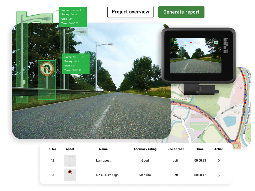
With RoadGaugeAI, conducting road surveys is easy, independent, and cost-effective. All one needs is an action camera, such as a GoPro, mounted on any vehicle at a height of 1.5 m. RoadGaugeAI helps the user with getting the right camera settings, mounting specifications, and other imaging guidelines to create compatible videos of the road. Surveys can be conducted at one’s convenience. Then the user uploads the survey videos directly to the web application, all from the office.
The user also pays through the RoadGaugeAI web application, where they set up their credit cards, review their past payments, check available credits, and get cost estimates for new projects. All this operation is highly automated and designed for superior user-friendliness. The RoadGaugeAI eco-system also has multiple visualizers for raw images and GPS data. These visualizers ensure that the user gets the chance to verify that they analyse the right data, before they process it (and lose money!).
The result? Within just two weeks, the user will receive a comprehensive assessment output, which is downloadable from the RoadGaugeAI web application. RoadGaugeAI output files can be used with map applications to visualize the outcomes. Data files are available to be used with pavement maintenance planning software. RoadGaugeAI gives you the tools and flexibility to make informed decisions effortlessly. Say goodbye to the hassles of the past and embrace the future of road survey analysis with RoadGaugeAI. Take the reins, gain independence, and simplify the way you assess roads.