
Surface inspection
3D profile your road surfaces with a GoPro camera
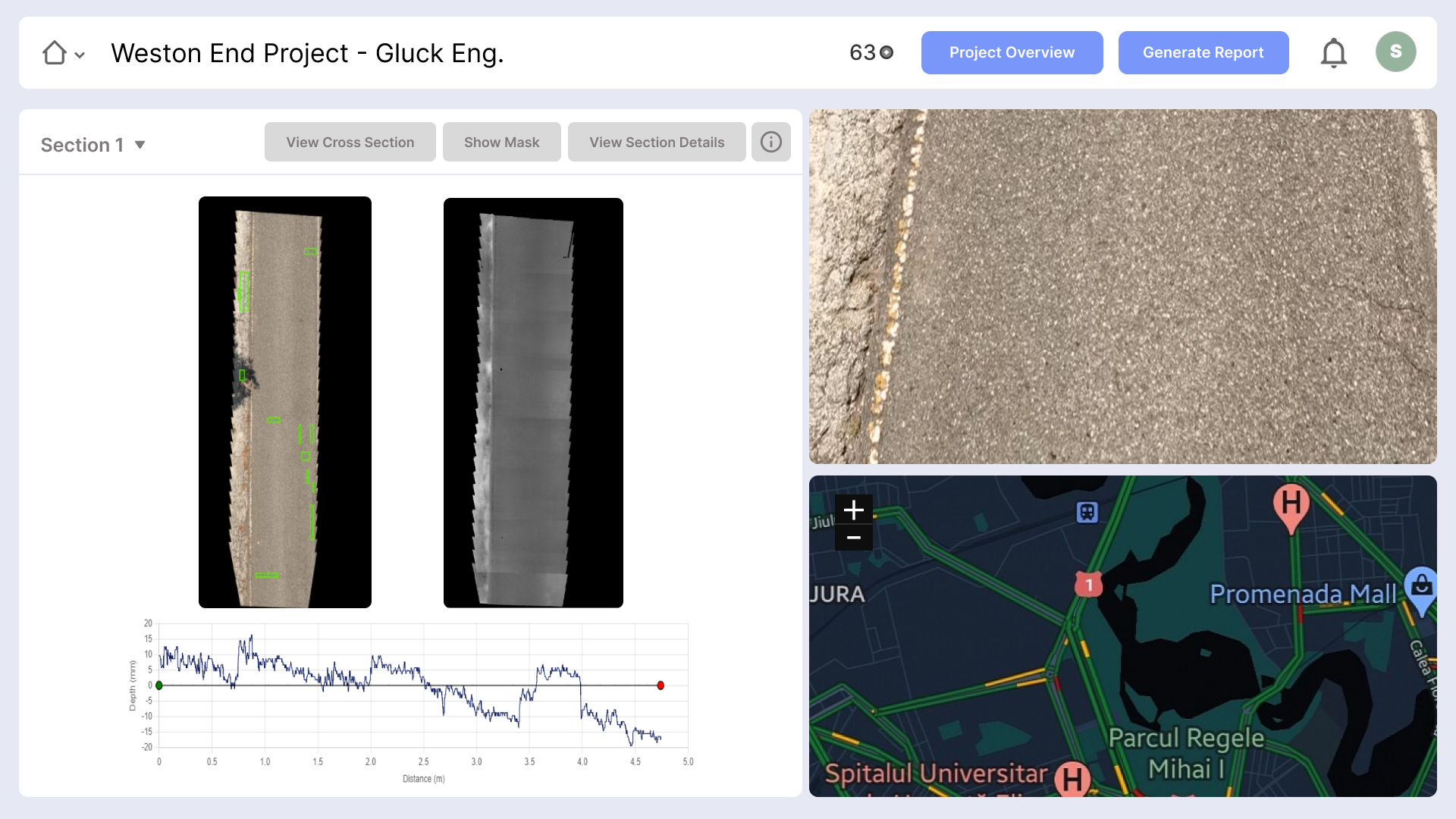
It is as simple as mounting a down-facing camera to the rear of a hatchback and taking a drive. Just remember to record while driving. Well, you also have to upload the video on the RoadGaugeAI web-app. That’s it. When you wake up, you can interact with the results via our web interface to understand just how bad or good your road condition is. You also get data files that can be used with maintenance optimisation software, geographic annotation files for cross-platform map visualisations, and a PDF report.
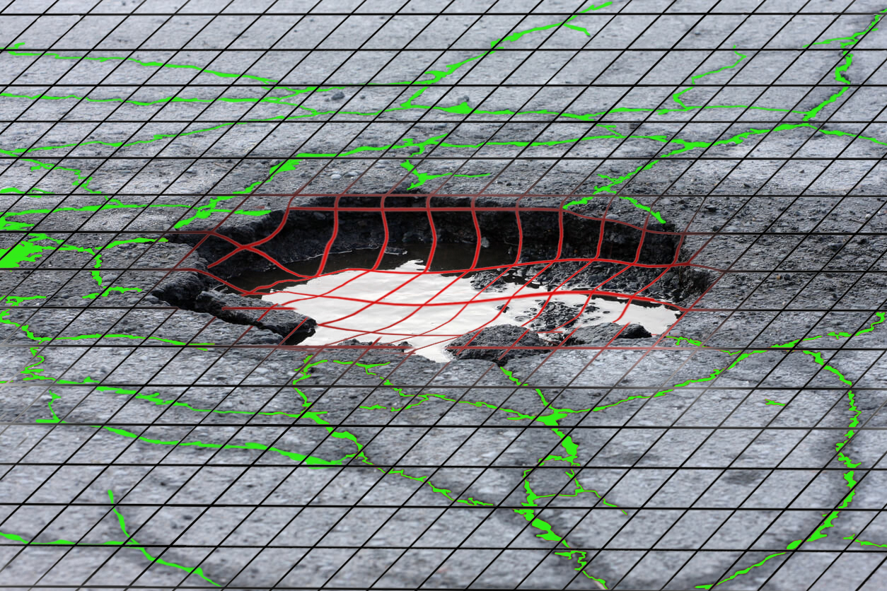
- Fully automated detection, dimensional measurement, visualisation, and mapping of distresses.
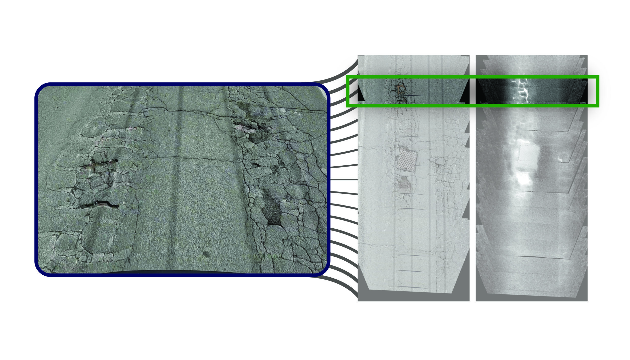
- Visualisation of longitudinal and transverse road profiles.
- Lengths, widths, depths, perimeter, and other linear measurements at ±3 mm accuracy; area at 10 mm2 accuracy.
- Own your hardware: buy a GoPro or a RoadScape3D – our powerful road inspection system designed for high-speed, high-volume road surveys (read the RoadScape3D brochure)
- Directly obtain road condition index (RCI) and pavement condition index (PCI)
RoadGauge AI capabilities
- Distinguishes between alligator, block, longitudinal, and lateral crack types
- Detects subsidence and measures severity
- Detects potholes, measures their depth and volume measurement as well as spans and areas
- Gauges ruts’ depth and classifies their severity
- Estimates the 3m and 10m longitudinal profile variations to ±3mm accuracy
- Flags edge deterioration while measuring and mapping lane marking quality
- Detects and maps iron works
RoadGaugeAI and you
- Data on demand, wherever you are. RoadGaugeAI web application keeps your surveys at your fingertips, a click away.
- Glitches? No sweat. Edit GPS tracks with ease, correcting for occlusions caused by tall buildings or bridge shadows – all within our post-editing suite.
- Plan like a pro. RoadGaugeAI’s survey planner anticipates sunlight, weather, and more to help you schedule your surveys for optimal data collection.
- Pay as you go, get what you need. RoadGaugeAI’s flexible processing and reporting options let you customise without overpaying.
- Team up seamlessly. Assign primary and secondary user accounts with granular control over finances and data access.
- Collaboration made easy. Share projects with clients and suppliers for no additional cost – perfect for open communication and streamlined workflows.